 | ||||||||||||||||||||||||||||||||||||||||||
| Snake river petroglyph site near Joseph Oregon |
It's a nice day trip from the Mountain View Motel &
RV Park near Joseph in the northeastern corner of Oregon, to see
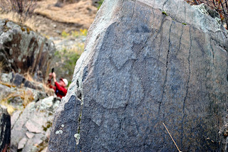
petroglyphs along the Snake River at the Buffalo Eddy historical site.
The artwork at Buffalo Eddy is attributed to the the Nimí'pu
(Nez Perce), who created the art between 300 and 4,500 years ago, according to
the National Park Service. The symbols are preserved on both the Washington and
Idaho sides of the river, but the glyphs on the Idaho side can only be viewed
from the water, which makes for a popular tour boat stop. Buffalo Eddy takes its name from some of the pictures on the Idaho side, which depict bison and hunters on horseback.To get there from the motel, turn left (north) on the Snake River Scenic Byway (Hwy 82) to Enterprise, then turn right at the Chevron station onto Oregon Route 3 toward Flora and Lewiston, Idaho. Fill up on gas in Enterprise because the next fuel is 79 miles north in Asotin, Washington, and these directions take a road that cuts off before then.
Two miles north of Enterprise, you may see buffalo grazing at
Stangel Bison Ranch. Grass fed bison meat from the ranch is locally available
at The Dollar Stretcher Grocery Store at Enterprise and at several local restaurants.
JOSEPH CANYON VIEWPOINT
The pullout at Joseph Canyon Viewpoint, 30 miles north of
Enterprise, features a beautiful vista of Joseph Canyon, where, tradition says,
Chief Joseph was born in a cave about 2,000 feet below. Joseph's band sometimes wintered at the base
of the canyon along Joseph Creek.
After about seven more miles, the road starts to wind down the switchbacks of Rattlesnake Grade. It's a striking landscape with the Grand Ronde River at the bottom. You'll cross into Washington on this stretch and the road turns into Hwy 129. Bogan's Oasis on the river is the only place on this trip to eat or get an order to go. If Bogan's is closed, there is another public restroom down the driveway on the right, next to the river where rafters put in. Then the highway continues snaking back up to the top of the plateau.
Just after leaving the trees past the Fields Spring State Park entrance, look for Montgomery Rd. on the right (58 miles past Enterprise). Follow this road east for 19 miles down to the Snake River. It turns from asphalt to dirt and changes to Sherry Grade Rd., then Crouse Creek Rd., before meeting the Snake River Rd.
BUFFALO EDDY PETROGLYPH SITE
Turn right on Snake River Rd. and drive 4.5 miles to the
Buffalo Eddy Petroglyph pullout. There is an interpretive sign and a short
trail along the river's edge. It leads to a tumble of rocks with many ancient symbols
scratched into them. How many can you find?
BONUS
You can tell people you've been to the deepest canyon in North America! Carved by the Snake River, it marks the border between Oregon and Idaho. The river lies more than a mile below the rim in Oregon and 8,000 feet below the highest peak of Idaho's Seven Devils Mountains. The best way to explore it is with a Hells Canyon Adventures guided tour.


